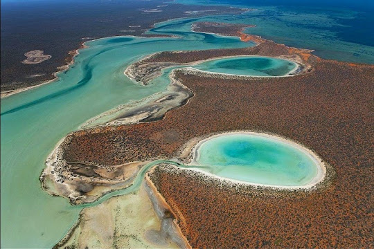
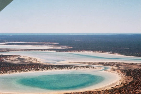
The most westerly point of the Australian continent, next to the Indian Ocean is called Shark Bay, an area of exceptional natural features and a World Heritage site. Scattered around Shark Bay, especially within Peron Peninsula inside the Francois Peron National Park, are several saline lakes of gypsum, known locally as birridas.
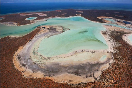
Thousands of years ago, when sea levels were much higher than they are today, birridas were landlocked saline lakes between sand dunes. The water was rich in sulphate of lime that was deposited onto the lake floor. When the sea level dropped, the lakes dried up creating salty hollows, and the sulphate of lime evaporated and became loose, powdery gypsum.
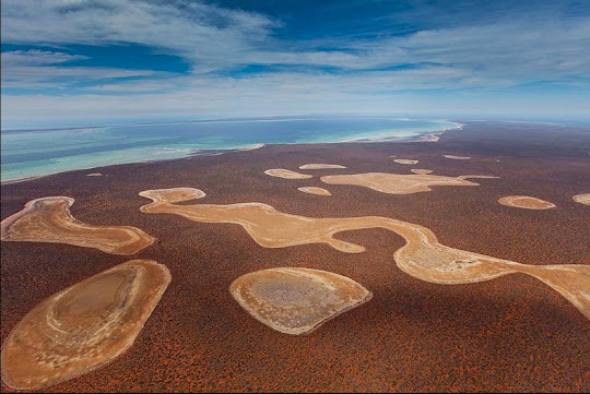
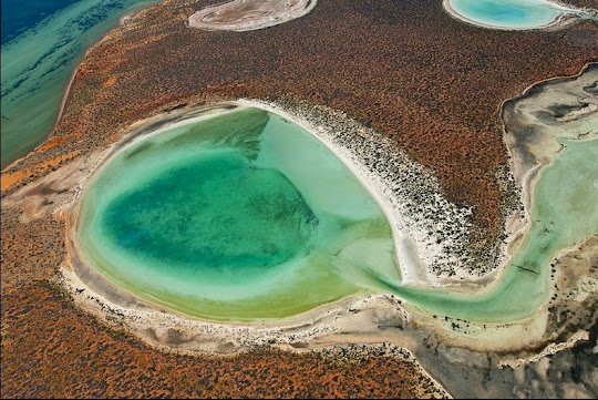
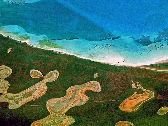
Birridas are circular or oval in shape and range from 100 m to 1 km wide. They commonly consist of a central, raised platform ringed by a moat-like depression. The central section corresponds to the level of the water table during the late Pleistocene Period, about 10 000 years ago. Today, during very high winter tides or after heavy rains, when the groundwater level is raised, these moats fill with water to a shallow level. Most birridas retain water for several months following rain. At these times, dormant eggs hatch and the birridas teem with brine shrimp, horse-shoe crabs and other invertebrates. They provide a feast for wading birds such as red-necked stints (Calidris ruficollis) and bar-tailed godwits (Limosa lapponica) that have migrated to Shark Bay from as far away as Siberia.
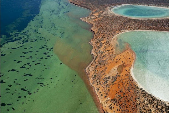
Some birridas are connected to the sea by channels and receive seawater, where they form shallow bays. These bays are important fish breeding and nursery areas, however, most birridas at Shark Bay are isolated.
Birridas are common in Francois Peron National Park where there are more than 100 on the east coast of the Peron Peninsula. You will see birridas when driving around the park, however to appreciate the shapes and sheer number of birridas it is best to take a flight.

Source
READ MORE»
Thousands of years ago, when sea levels were much higher than they are today, birridas were landlocked saline lakes between sand dunes. The water was rich in sulphate of lime that was deposited onto the lake floor. When the sea level dropped, the lakes dried up creating salty hollows, and the sulphate of lime evaporated and became loose, powdery gypsum.
Birridas are circular or oval in shape and range from 100 m to 1 km wide. They commonly consist of a central, raised platform ringed by a moat-like depression. The central section corresponds to the level of the water table during the late Pleistocene Period, about 10 000 years ago. Today, during very high winter tides or after heavy rains, when the groundwater level is raised, these moats fill with water to a shallow level. Most birridas retain water for several months following rain. At these times, dormant eggs hatch and the birridas teem with brine shrimp, horse-shoe crabs and other invertebrates. They provide a feast for wading birds such as red-necked stints (Calidris ruficollis) and bar-tailed godwits (Limosa lapponica) that have migrated to Shark Bay from as far away as Siberia.
Some birridas are connected to the sea by channels and receive seawater, where they form shallow bays. These bays are important fish breeding and nursery areas, however, most birridas at Shark Bay are isolated.
Birridas are common in Francois Peron National Park where there are more than 100 on the east coast of the Peron Peninsula. You will see birridas when driving around the park, however to appreciate the shapes and sheer number of birridas it is best to take a flight.
Source