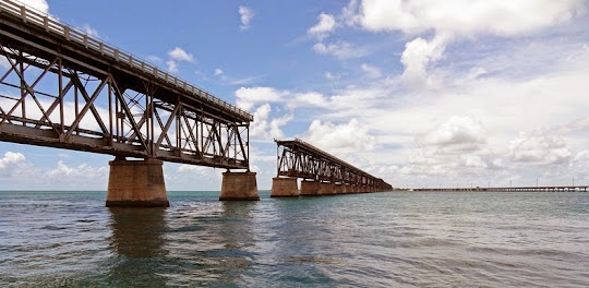
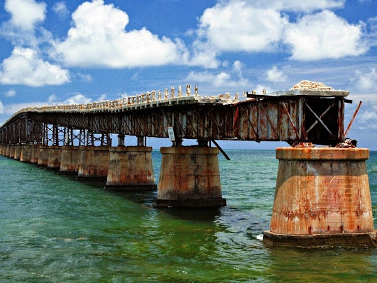
The Bahia Honda Rail Bridge is an abandoned bridge in the lower Florida Keys connecting Bahia Honda Key with Spanish Harbor Key. The bridge was originally built between 1905 and 1912 by billionaire Henry Flagler, who was a partner in Standard Oil with John D. Rockerfeller, as part of the Overseas Railroad. It was intended to carry a single track of the Florida East Coast Railway across the Big Spanish Channel from Bahia Honda Key to Spanish Harbor Key. Due to the channel’s depth, being 24-feet at it’s deepest point, the Bahia Honda Bridge was built with a steel truss construction as apposed to a concrete arch form that was predominate throughout the Overseas Railway.

Building the railroad was a stupendous labor and engineering challenge. The Florida Keys were periodically swept by storms that killed thousands of workers during the construction period. On Labor Day, in 1935, one of the strongest hurricanes on record hit the Florida Keys, damaging the bridge and killing hundreds of WWI veterans working on a WPA bridge project. The overseas railroad came to an end and the bridge was sold to the State of Florida in 1938, who converted it for highway use.
Rather than completely rebuilding the bridge after the hurricane, the existing structure was repaired and the deck for the highway was added on top, as the existing deck inside the truss was too narrow for vehicular traffic. The bridge served as the primary mode of transport to the islands of the lower Keys, and as a primary evacuation route.
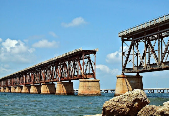
When a new four-lane bridge was built in 1980, a few hundred yards north of the old bridge, two spans of the bridge were removed to accommodate boat traffic and make the majority of the bridge inaccessible to pedestrian traffic. While most of the bridge has be abandoned, the easternmost section of the bridge is open to pedestrian traffic and provides a scenic overview of the area.


Source
READ MORE»
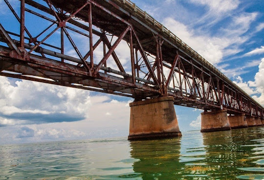
Building the railroad was a stupendous labor and engineering challenge. The Florida Keys were periodically swept by storms that killed thousands of workers during the construction period. On Labor Day, in 1935, one of the strongest hurricanes on record hit the Florida Keys, damaging the bridge and killing hundreds of WWI veterans working on a WPA bridge project. The overseas railroad came to an end and the bridge was sold to the State of Florida in 1938, who converted it for highway use.
Rather than completely rebuilding the bridge after the hurricane, the existing structure was repaired and the deck for the highway was added on top, as the existing deck inside the truss was too narrow for vehicular traffic. The bridge served as the primary mode of transport to the islands of the lower Keys, and as a primary evacuation route.
When a new four-lane bridge was built in 1980, a few hundred yards north of the old bridge, two spans of the bridge were removed to accommodate boat traffic and make the majority of the bridge inaccessible to pedestrian traffic. While most of the bridge has be abandoned, the easternmost section of the bridge is open to pedestrian traffic and provides a scenic overview of the area.
Source